
Clarksville ZIP Service Areas
The documented Clarksville postal set runs from 37040 through 37044. These ZIP codes describe delivery or mailing geography, not legal municipal borders. Neighborhood labels in the table are deliberately broad because no official city source assigned every neighborhood to a single postal area. For an actual address, USPS remains the controlling delivery check. The Regional Planning Commission and county parcel tools answer different location questions.
| ZIP | Areas Covered | Post Office | Notes |
|---|---|---|---|
| 37040 | Central Clarksville and county-seat delivery area | Clarksville postal delivery area | Includes downtown and civic-address context; verify each street because postal and city lines differ. |
| 37041 | Clarksville postal-box and mailing use | Clarksville post-office mailing designation | Treat as a PO Box or mailing ZIP, not a geographic neighborhood. |
| 37042 | North and west Clarksville delivery geography, including the Fort Campbell Boulevard side | Clarksville delivery area | City and county boundaries make address-level verification essential. |
| 37043 | East and southeast delivery geography, commonly including Sango and Hilldale-side addresses | Clarksville delivery area | Delivery geography extends beyond a simple municipal-neighborhood label. |
| 37044 | Austin Peay State University institutional geography | Austin Peay State University | Unique ZIP, not a general delivery designation for adjacent streets. |
USPS provides the authoritative address check through its postal lookup interface.
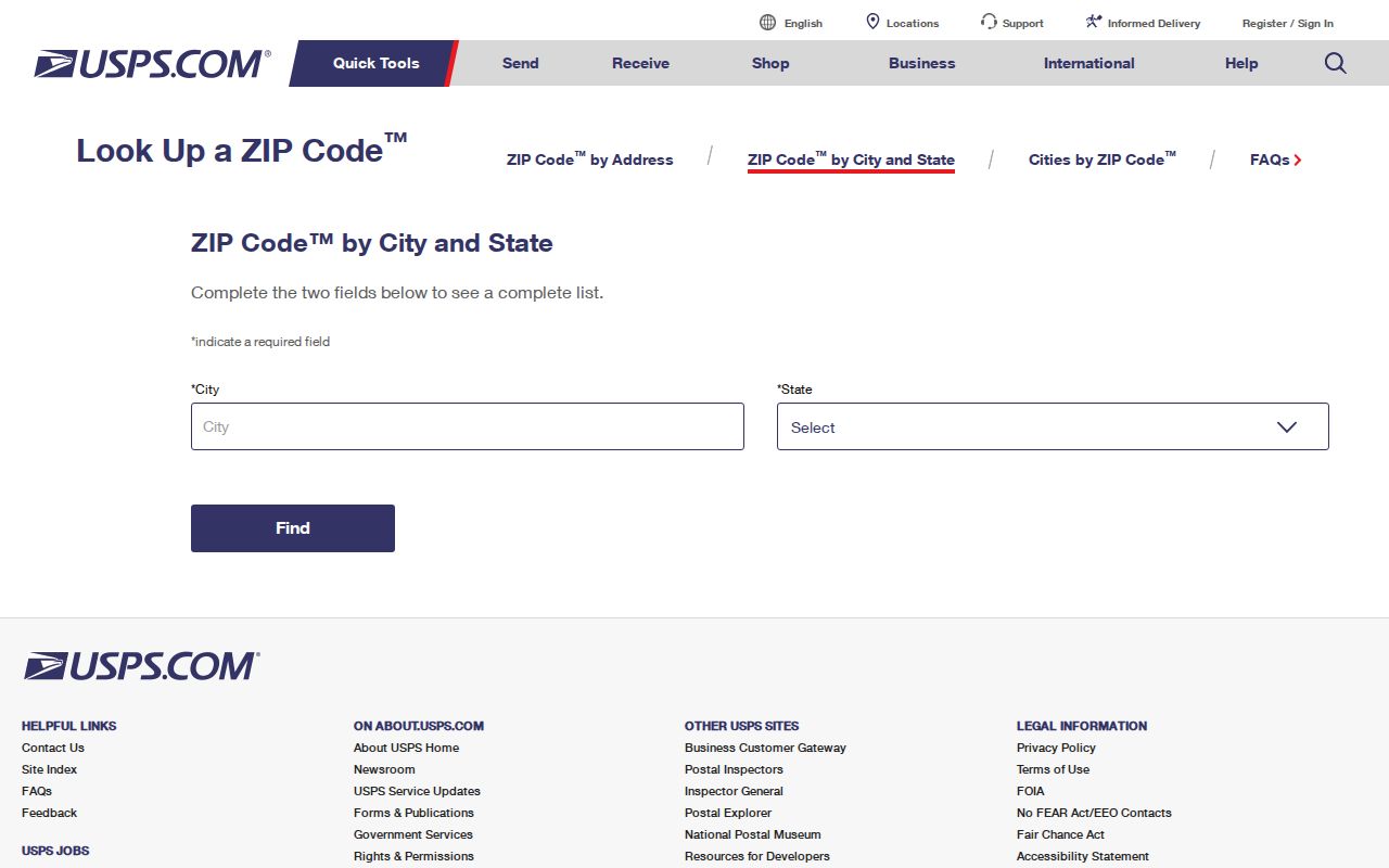
The postal lookup verifies the mailing ZIP for a particular address. It does not establish city limits, a parcel boundary, or a legal description.
Checking a Clarksville Delivery ZIP
Begin with the delivery address, not a neighborhood assumption. USPS accepts a street address with city and state, or a city and state lookup, then returns a standardized address and ZIP when it can make a match. Keep that result with the search notes. It is the postal answer to a postal question. If the next question concerns city service, taxation, annexation, or a parcel, move to the office that keeps that kind of record.
- Enter the complete street address with Clarksville and Tennessee when the delivery address is known.
- Keep the returned standardized address and ZIP with the date of the check.
- Use the ZIP result to orient a search, not to identify a city boundary or a full list of people.
- Compare the location with the Regional Planning Commission map or Assessor parcel record when jurisdiction matters.
- Use the proper custodian for the actual record, such as a deed, tax account, court file, or permit.
A city name on mail can describe a postal service area even where the actual parcel lies outside the corporate limits. The reverse problem also occurs: a city address can need a postal label that does not match a reader's expected neighborhood name. Postal geography is useful, but it does not move a record from one custodian to another.
Note: Retain the USPS result as delivery evidence only; it is not a substitute for an Assessor record, recorded plat, or annexation map.
Clarksville ZIP Search Limits
Several local and state tools are useful after a ZIP is verified, but the documented interfaces do not support a ZIP-wide people, parcel, or voter search. It is more accurate to search the feature each portal actually provides. The property card is keyed to owner, property, parcel, or map work. The voter form is a person-specific registration confirmation service. The map viewer supports parcel and overlay browsing, while the Planning Commission names ZIP codes as an Information Lookup feature for geographic orientation.
| Portal or record | ZIP filtering documented | Proven Clarksville use |
|---|---|---|
| Spatialest property search | No ZIP filter documented | Search owner, property, or parcel; then review the property card or map. |
| TPAD advanced search | No ZIP field displayed | Use owner, address, parcel, subdivision, classification, or sale-date inputs. |
| City real-estate tax portal | No ZIP field documented | Use house number and street, owner, parcel, bill number, and tax year. |
| Tennessee voter lookup | No ZIP field documented | Confirm one registration with county, first name, last name, birth month, and birth year. |
| Stratum GIS viewer | No ZIP query control documented | Browse parcels and enabled map overlays by address, click, pan, and zoom. |
| RPC Information Lookup | ZIP codes listed as a feature | Use for geographic orientation, then verify delivery ZIP with USPS. |
This is a proven non-ZIP filtering table, not a list of hidden workarounds. The research did not document a ZIP-wide Assessor, voter, GIS, or city-tax filter, so none should be promised.
Clarksville ZIP Parcel Terms
A single Clarksville property can have three different address descriptions. Keeping them separate makes a ZIP search more reliable. The Assessor record card distinguishes the physical property address from the owner's mailing address. Deed and plat work adds the legal description, which may be a lot, block, subdivision, or metes-and-bounds description. The Register of Deeds uses named grantor and grantee parties, so the legal description and recorded book or page reference are the bridge from a parcel to a deed.
- ZIP code
- A postal delivery or mailing designation. It is not a city-limit line, voter precinct, tax district, census tract, or legal description.
- ZIP+4
- An added postal delivery detail used with a base ZIP. Confirm it with USPS for the specific address.
- PO Box ZIP
- A mailing designation for post-office box use. It should not be read as the location of a parcel.
- Unique ZIP
- A postal designation assigned to one institution or organization. Clarksville's documented example is Austin Peay State University.
- Carrier route
- A postal delivery grouping. It is not a substitute for a parcel number, district, or legal boundary.
- Situs address
- The physical parcel location used for Assessor, GIS, permit, and map work. It does not prove who is presently there.
The Montgomery County Spatialest property card separates mailing and property-address fields. A mailing ZIP may differ from the situs ZIP because notices can go elsewhere. Label both fields and verify the requested delivery address through USPS before treating either one as a location answer.
Clarksville ZIP Areas and City Limits
ZIP boundaries and Clarksville's corporate limits do not line up. An address may use Clarksville as its mailing city while falling outside the city limits, and the proper service or record question still depends on the parcel's actual geography. For city-government questions, the Regional Planning Commission's annexation-by-decade map is a useful companion. For tax parcel geography, use the Assessor. USPS remains the delivery authority, so neither map source should be described as a replacement for postal verification.
That mismatch matters when a search starts with a broad ZIP. A 37042 or 37043 mailing address can point to a familiar Clarksville delivery area without confirming municipal jurisdiction. A location can also be in city or county service territory for a particular government function based on its parcel and annexation history. Compare the delivery result, the situs address, and the relevant map before making a records request.
Clarksville ZIP Maps at the RPC
The Clarksville-Montgomery County Regional Planning Commission is the joint city and county body that manages addressing, GIS, development review, and the Master Street Address Guide. Formed in 1963, it supplies a local map layer between a mailing label and a government record. Its map hub offers Information Lookup features for ZIP codes, elected officials, zoning, and planning areas, plus maps for subdivisions, wards, flood areas, growth-plan areas, and annexations by decade from 1964 forward.
The Regional Planning Commission map hub is the right map starting point when an address needs city or county context.
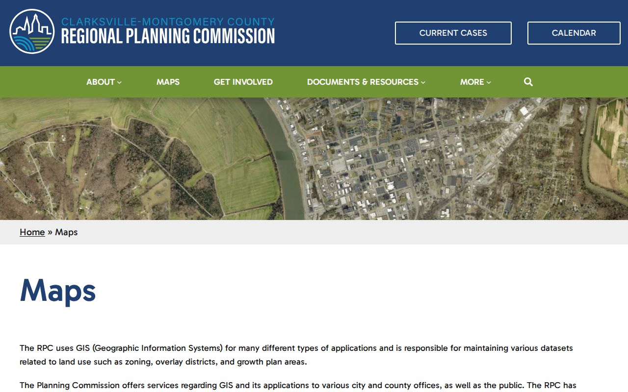
The map hub adds civic and parcel context to a ZIP search. It does not certify a delivery ZIP or replace a recorded plat for a boundary decision.
Clarksville ZIP 37044 Exception
Clarksville's special postal exception is 37044, the unique ZIP for Austin Peay State University. It is institutional postal geography, not an ordinary neighborhood delivery zone. Do not extend it to nearby streets or use it to infer a person's connection to the university. When an address near the campus raises a ZIP question, submit the exact delivery address to USPS and then use the parcel or map record for the physical location.
The distinction is small but important. A unique ZIP can make adjacent addresses look more closely related in a quick search than the postal system actually treats them. Clarksville has five documented ZIP designations in the 37040-37044 set, and 37044 has a different role from the other delivery or mailing entries. That documented difference is the reason for the extra caution.
Using the Clarksville ZIP Code Directory
A ZIP is best used to organize an address question, then hand it to the record system that keeps the needed fact. After USPS confirms the delivery ZIP, use the Regional Planning Commission for city or county context, the Assessor for the parcel card, and the Register of Deeds for a legal transfer trail. The documented Assessor and GIS tools do not filter whole result sets by ZIP, so narrow to a property address, owner, parcel, or map point instead.
- Verify the exact delivery ZIP through USPS.
- Check the RPC map when city limits, annexation, or planning geography matters.
- Find the parcel through the Assessor's property card or Stratum map using a documented address, owner, or parcel method.
- Separate the situs address, mailing address, and legal description in the research notes.
- For a street-by-street parcel workflow, use the Clarksville street directory after the postal area is narrowed.
No ZIP changes which office owns the underlying record. A confirmed ZIP makes a search more orderly, but it does not turn an address lookup into a roster or a map into a deed.
Note: Use ZIP information for lawful personal, family-history, property, or civic research, and never to stalk, harass, or harm another person.